i
Staten Island · Staten Island
The blue trail over Moses Mountain
- Range
- Staten Island
- Habitat
- Oak and tulip woods
- Kettle ponds and swamps
- Rocky hilltops
- Field marks
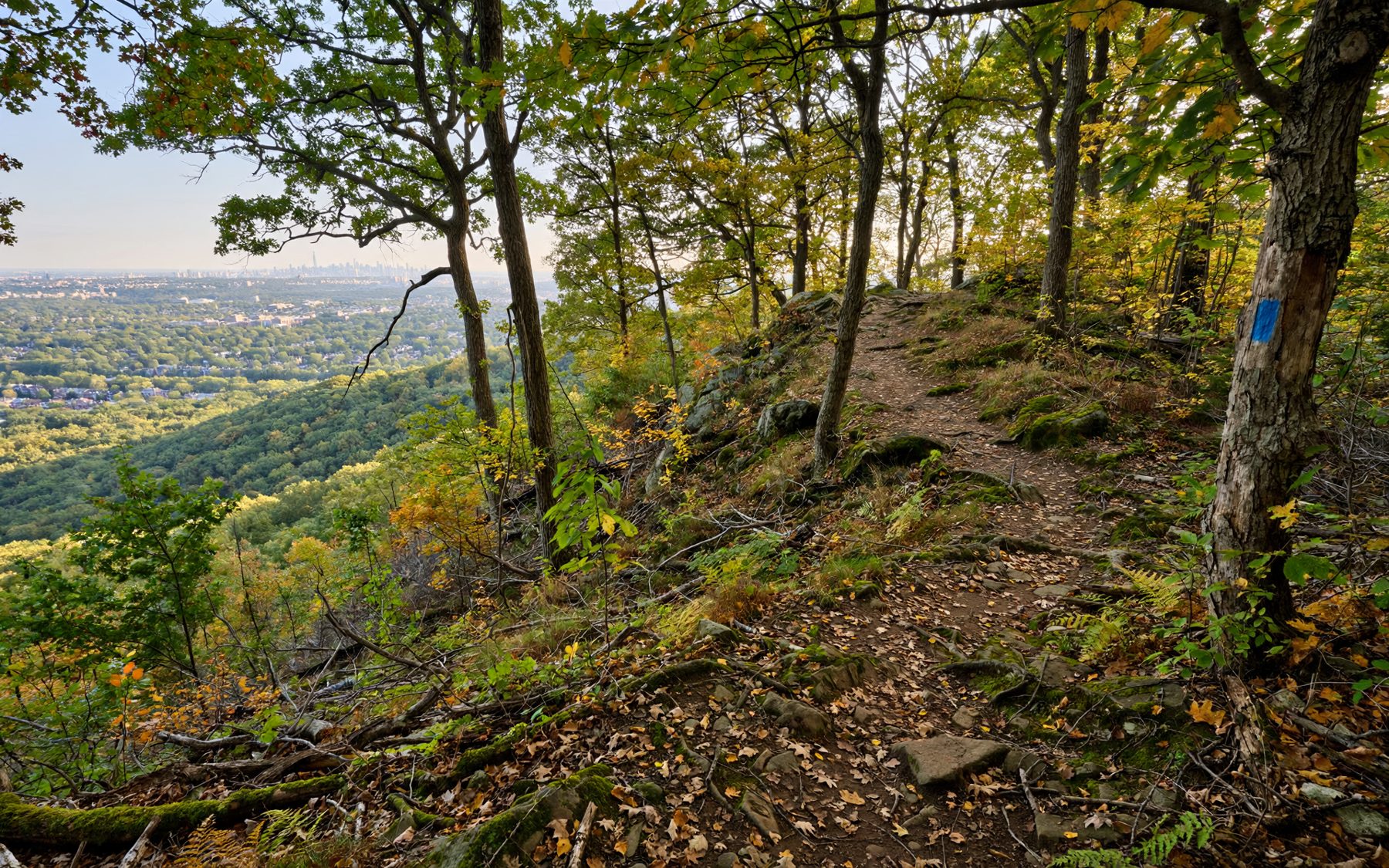
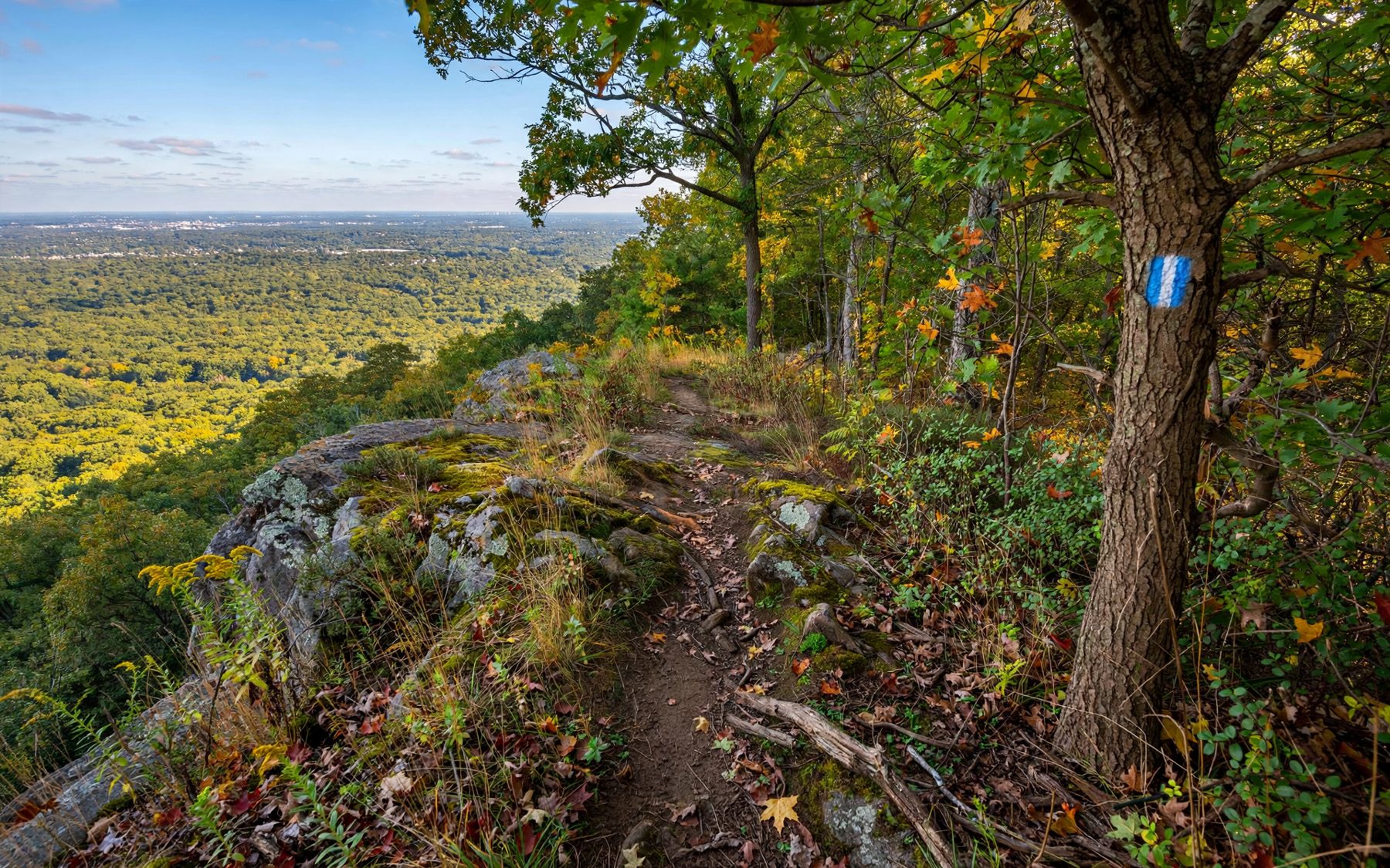
- Blue paint blazes on tree trunks, rolling oak woods, small dark ponds, a rocky open summit with treetop views, very few people on weekdays.
- Best season
- April, May, October
- Transit
- Staten Island Ferry, then a bus inland
- From Midtown
- Ferry to St. George, then a bus
- Pack
- Water, map, sturdy shoes, repellent, a snack
Most people who know Staten Island know it from the ferry rail: a hill of houses rising behind St. George. Fewer know that the middle of the island, a few miles inland, is a long ridge of woodland that you can cross on foot without meeting a road for long stretches. This is the Staten Island Greenbelt, roughly 2,800 acres of connected parkland, and the blue trail is the thread that runs through most of it.
The Greenbelt is not one park but several that touch: High Rock Park, Latourette Park, Willowbrook Park, the woods around Todt Hill and a scatter of smaller tracts, joined by trails that are marked with colored paint. The blue trail is the long one. You do not have to walk all of it. Most visitors pick a section of two to five miles, and the stretch from High Rock over Moses Mountain is the one with the most variety for its length.
Paint on bark: how the blazes work
Every marked trail in the Greenbelt has its own color, painted as small upright rectangles on tree trunks at about eye height. Blue, red, white and yellow trails cross and share short sections, so the color is your only real guide at junctions. A few conventions help:
- One blaze means carry on along the path you are on.
- Two blazes stacked warn of a turn ahead. If the upper blaze is offset to one side, the trail turns that way.
- No blaze for a long while usually means you have drifted onto an unmarked path. Walk back to the last blaze you saw rather than pressing on.
Blazes fade and trees fall, and side paths made by runners and bikes can look more worn than the marked route. Carry a printed or downloaded trail map, because phone signal under the canopy is patchy in places.
High Rock and its ponds
High Rock Park is a good place to start, with a small parking area, paths that branch quickly into the woods and several ponds and swamps tucked into hollows left by the last glacier. In early spring these hollows are loud. From late March and through April, spring peepers, tiny tan tree frogs with a dark X on the back, call from the wet edges after dark and on mild, damp afternoons. The sound is a high, rising peep repeated over and over, and a full chorus can carry well up the slope. Wood frogs call earlier and sound more like distant ducks.
You will almost never see a peeper. They sit low in the grass and go quiet as you approach, so stand still for a minute and the chorus usually starts again around you. Stay on the trail: the pond edges are where egg masses and young frogs are, and trampled banks take a long time to recover.
In May the woods fill with migrant songbirds. The Greenbelt sees the same waves of warblers as the parks of Manhattan and Brooklyn, though they are spread across far more trees and you work harder for each one; if warblers are your aim, read about the spring warblers at Inwood first. Wood thrushes, which nest in larger unbroken forest, sing here in late spring and summer evenings.
Up Moses Mountain
The odd name comes with an odd history. In the middle of the last century a parkway was planned straight through these woods, part of the road-building program associated with Robert Moses. Crews began clearing and blasting, and the broken rock was piled into a hill. Then local opposition grew, the road was abandoned, and the land became parkland instead. The pile stayed. Today it is a steep, rocky knob with trees growing up its sides, and the blue trail climbs it.
The road was never built, and the rubble from it became a lookout.
The road was never built, and the rubble from it became a lookout. The climb is short but steep in places, over loose stones and exposed rock, so take it slowly in wet weather. From the top you look out over a rolling sea of treetops, with the taller hills of the island around you and, on clear days, glimpses of the wider region beyond. It is one of the few places in the city where you can see that much forest at once.
Compare plate XFerry, bus and High Rock: a day without a carHilltops like this one are also good places to watch the sky. In September and October hawks drift south along the ridges of the region, and a patient hour on top can turn up a few. Turkey vultures circle here through much of the year, rocking on wings held in a shallow V.
South to Latourette
Beyond Moses Mountain the blue trail continues south through mixed woods, crossing small streams on stones and plank bridges, and eventually reaches Latourette Park. The trail is quieter here and the ground more rolling. Look for big tulip trees, with their straight gray trunks and leaves shaped like a cat's face, and for the white blooms of dogwood in the understory in spring.
i
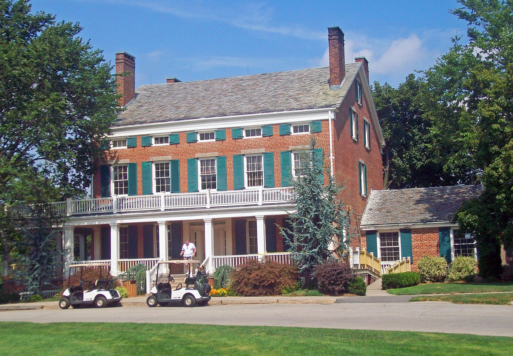
At the edge of the park stands LaTourette House, a red-brick nineteenth-century mansion with green shutters and a long porch, which sits beside the park's golf course. The open lawns around it are a change from the woods and a good place to look for bluebirds and swallows in summer. From here the Greenbelt continues south toward Historic Richmond Town and the lower slopes of the hill.
Autumn, when the canopy turns
October is the other high season. The oaks, hickories, maples, sweetgums and tulip trees turn in sequence rather than all at once, so the color moves through the woods over several weeks, usually peaking in the second half of the month. Sweetgum leaves can go every shade from yellow to deep purple on a single tree. On calm days the paths are carpeted and quiet, and you can hear chipmunks and squirrels working the fallen acorns.
Fall is also the start of the best walking weather. The ticks that are so busy in early summer are fewer once the frosts come, though not gone, and the mosquitoes that hang around the ponds in June are mostly finished.
Ticks, signal and the Nature Center
The Greenbelt Nature Center sits near the middle of the park and is the best place to pick up a map, ask about trail conditions and see small exhibits on the local wildlife. Its hours vary by season and are reduced in winter, so check before you go. Trail sections close from time to time for storm damage and restoration work; respect the signs.
Ticks are common in the Greenbelt from spring through fall, including the deer ticks that can carry Lyme disease. Wear long trousers tucked into socks, use repellent and check yourself and any companions when you get home. Poison ivy grows along many trail edges as a low plant and as hairy vines on trunks. Water is not reliably available on the trails, so carry what you need.
The Greenbelt's woods are dark early, especially in the hollows. Plan to be back at a road well before sunset, because the trails are unlit and the blazes are hard to find with a phone light. If you are coming by public transport, the details of the ferry and bus are covered in a day without a car. For another island preserve with a very different feel, sandy and flat, see Clay Pit Ponds on the island's southwest shore.